Ridgway to Basalt, by way of McClure Pass. Colorado Highway 133 from Hotchkiss through Paonia, Somerset, past the Marble turnoff, Redstone, and Carbondale. Another one of our favorite roads. McClure Pass. Not a dramatic “winding wonder” (as Elle calls it), like Red Mountain Pass, not even nine thousand feet high, but wide-open and scenic; rolling hills entirely covered with Aspen. No color left on the hillsides now, except for the color of the million or so leafless aspen trunks. Quite a bit of cottonwood and narrowleaf cottonwood color left in the river bottoms. With an early start, we were through it all and settled in here in time for the afternoon games. Today’s crock pot torture: pot roast, potatoes, carrots, celery, and onions. All day. A busy week next week. Jobs in Glenwood Springs, Carbondale, and Aspen. We’re parked in the middle, so we’re within twenty miles of everybody. No waxwings, but we have seen some Lewis’s Woodpeckers.
Cortez to Ridgway
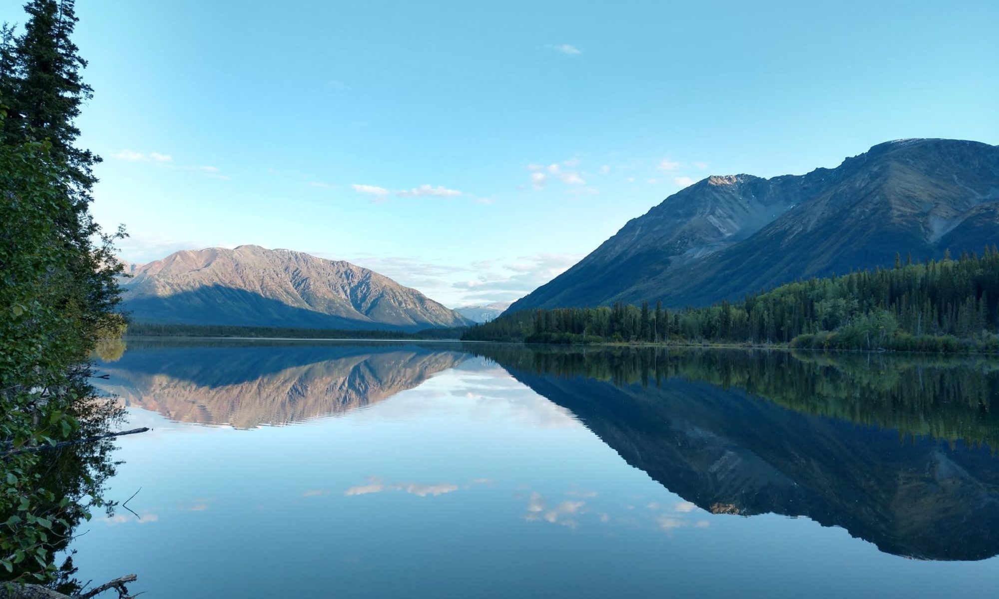
It’s only a hundred thirty miles. How hard could it be? We usually go over lizard head pass, or out and around by Naturita to avoid the highest passes, but since we hadn’t been the Durango route recently, we decided to go that way. Cortez to Durango, Silverton, Ouray, and Ridgway. A three-humper, not counting that little one between Cortez and Durango. Three big humps, Coal Bank, Molas, and Red Mountain Passes. Nine thousand, ten thousand and eleven thousand feet. A lot of 15mph winding and grinding in low gear, both on the way up and on the way down. A fantastic drive. And hardly another car on the road. We never collected more than two or three at a time, and then only for a few minutes before we got a chance to let them by. The fall colors are on the ground now; ground blizzards of color swirling up behind as we pass. Hundreds of waterfalls; foamy intertwined ribbons of white cascading down the mountains in every direction. And now, one more day at Ridgway.
Along the way

The bridge

From our campground near Canon City, we had a view of the Royal Gorge Bridge, the highest suspension bridge in the world. It’s a thousand feet straight down to the Arkansas River below. What an engineering feat! Here you are, bumbling across the hills and you come upon this impassable obstacle. How to get across? It is way too deep and steep to go down one side and back up the other. Sheer rock walls. You have to get to the other side, so American ingenuity comes into play. You drill into the rock and build pilings on each side of the canyon. You drop the smallest lines you can to the bottom of the gorge, tie them together and pull them back up. From there, you start passing cables, one strand at a time, back and forth until finally you have assembled it, the world’s highest suspension bridge. Amazing! Wait a minute…. What’s wrong with this picture? I’m sitting out here in the gently rolling hills, looking out at the world’s highest suspension bridge. I’m looking up at the bridge. Something’s not right. Why am I sitting here a couple miles away from the bridge looking up at it? If they had to get to the other side of the canyon, why didn’t they just build a bridge over here, fifty feet above the river? Why didn’t they go down the road a mile, where the highway crosses the Arkansas River, at river level, on an old cement bridge fifty feet across? The Royal Gorge is deep, but it is not very long; only a few miles. You have to go out of your way to get to an overlook to see down in it. If you’re not careful, you’ll miss it and just go around without even knowing it’s there. We drive to the top, to the bridge. Cross the bridge. Know what’s on the other side? Know where the road to the other side goes? Nowhere! There is nothing on the other side of the bridge but a picnic area! There is no purpose to this bridge other than to be a bridge. Nobody needed this bridge. They built it because they could. I feel so cheated.
Along the way
